January 31, my Son-in-law, Mark, took my friend Ann and me to San Jose airport. Thank goodness he works in San Jose, as this isn’t the first time I’ve hitched a ride on his way to work. We had no problems or delays with our flight, and I enjoyed the views of the southwest out my window on the way to Dallas to change planes. (Clicking on pictures enlarges them.)

View from the plane over New Mexico (I think)
It was still a long time before we got to Quito. Thankfully, after we got our bags and got through customs, as we exited the airport, there was a nice man with a sign with our names on it. Just what I was hoping to see! He took us to a van which took about an hour to get to the Sheraton Hotel in Quito. We made it! That hotel is probably as fancy as any I’ve stayed in and the staff was friendly and helpful.
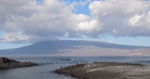
February 1. We enjoyed the views of Quito out the hotel windows. Cotopaxi volcano was easily visible with its white snow cap.
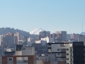
View to Cotopaxi from the Sheraton Hotel, Quito
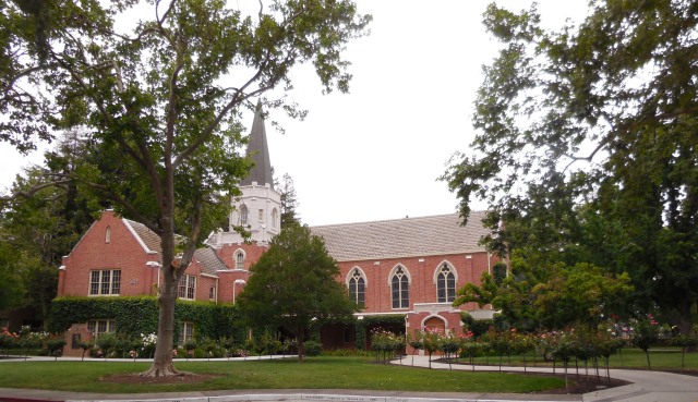
The whole Road Scholar group had an orientation after breakfast, then we were off on a tour of Old Quito, a UNESCO World Heritage site. It’s definitely the nicest looking part of the city. First stop was outside a Gothic-style cathedral. We didn’t go inside, which I would like to have done. On the outside, the gargoyles of European cathedrals were replaced by native and Galapagos animals.

Iguana and Tortoise gargoyles
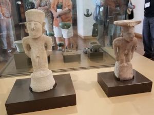
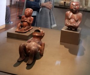
Our expert guide, Luis, told us a lot about the history of Equador and Quito. He had majored in Ecuadorean history in college with plans of becoming a tour guide. Indigenous people were trying to sell us scarves and paintings. I resisted because I’d left my wallet on the bus. You don’t need to exchange money in Equador because the American dollar is their currency. Next was a museum of Pre-Colombian art and artifacts, Museo Casa del Alabado. It was truly amazing. There were some themes to their artwork, and some suggested meanings, all explained to us by Luis. There were thousands of items, and I took as many photos as I could, though some were impossible due to reflections on the cases. Duality is one of the themes, which is part of the explanation for a figure of a man trying to give birth.
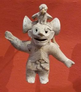
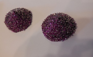
Charm
We spent some time in a gift shop, which seemed to have small rooms going on forever, with different items in each. All kinds of crafts and souvenirs, replicas of Pre-Colombian art, etc. I found a bar of Ecuadorian chocolate flavored with rose. Outside, we again had indigenous people trying to sell scarves and paintings. I bought a small painting with llamas, sheep, peasants, and Cotopaxi in the background, done on sheepskin, and I bought a scarf for my daughter. We walked across the front of the Presidential Palace just in time to see the changing of the guard. Lunch was at Café Plaza Grande, in an old building and featured a special dessert. The dessert was ice cream, but it was served by a person dressed as a cucurucho (Google it) and the bowl with the ice cream is placed over a bowl with some dry ice to keep it cold, so there’s the white mist coming out around it. Also, there are bells chiming as it’s served.
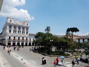
The building where we ate lunch.
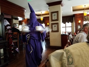
Cucurucho serving ice cream over dry ice.
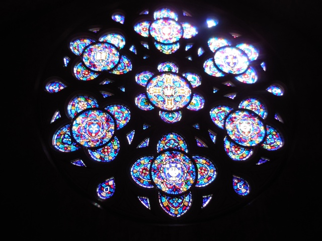
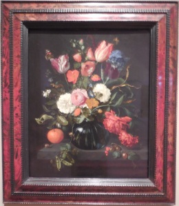
We went inside a Baroque–style cathedral, La Compañía de Jesús,where it seemed everything inside was covered with gold leaf. Truly amazing, and we weren’t allowed to take pictures. One group member bought a few postcards and sent me photos of them. (You can also google more photos)
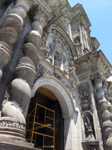
Outside of the Baroque -style Cathedral

Photo of the postcard of the inside of the cathedral
We then took the bus to Capilla del Hombre which showcases the work of Oswaldo Guayasamin, a famous local artist.There was a very impressive painting of an Andean condor attacking a bull, signifying the determination of the Ecuadoreans to rid themselves of Spanish rule.
Back at the hotel, we had a speaker (didn’t write down his name) who talked about the geography, geology, and history of Equador, the Andes, and the Galapagos. After dinner, we were free to do what we wanted for the evening. We all went to bed immediately.
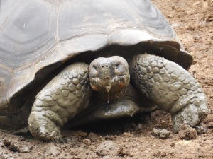
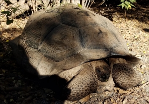
Feb 2. We had to get up early, pack and get on the bus to the airport to make our flight to the Galapagos. We arrived at Baltra Airport a few hours later, where we were met by Juan, our third- generation Galapagueno naturalist guide. (Baltra was a US base during WWII and Juan’s grandfather was an Ecuadorean civilian working at the base. After the war he moved to Galapagos permanently.) Again our bags were screened before we were released. Our luggage went on one vehicle to be taken to our yacht, and we were on a bus to the ferry boat for a short ride to Santa Cruz Island, so two and a half days after leaving Santa Cruz, I was in Santa Cruz.We boarded a bus and went south across the island to a place called Manzanillo, a restaurant where the tortoises come to breed. Manzanillo is also the name of a poisonous tree that looks a bit like a crabapple, so they warn people right away not to touch. The tortoises were everywhere. The 100-year-old males weigh 500 lbs! You can get an idea of their age from the plates on their backs. If the ridges are still prominent, they are relatively young. If they’ve worn down, they are older. They don’t want people coming right up to them, and you’re supposed to stay 6’ away, but they walked fairly close to us.


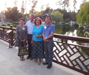
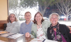
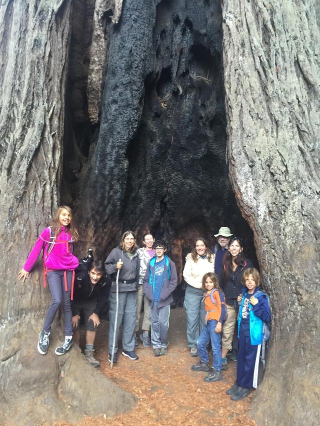
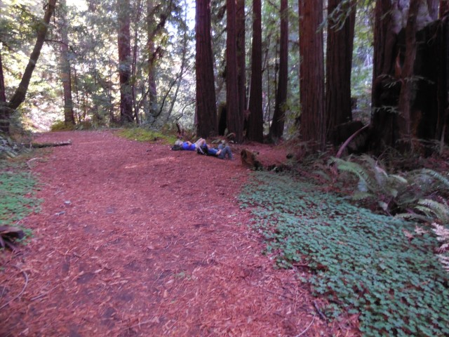
Me and some friends
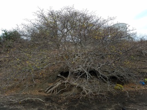
There were hammocks strung up to a grove of trees for bus drivers to take a nap while the tourists they bring there have lunch and watch tortoises. The tortoises walked right up to the hammocks. Besides tortoises, we saw Darwin finches, mockingbirds, a yellow warbler, and white-cheeked pintail ducks, and strange plants. Most of the island is covered with palo santo trees- similar to frankincense. It was supposed to be the rainy season, but like California, the rain was holding off. The Palo Santos hadn’t leafed out yet, so they were bare. All the islands had that for the main tree cover. Some tall trees near the restaurant were called “Seca”. They produced a seed pod that covered the ground near them. Mature pods opened like 5-pointed stars. I haven’t been able to find this tree in books on the yacht or on the internet. I’ve since read that some trees here were planted by the owner, and not endemic to the Galapagos.

My first Darwins FInch
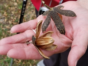
Seca seed pods

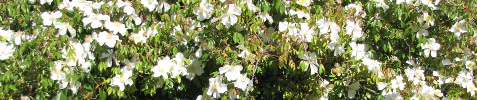
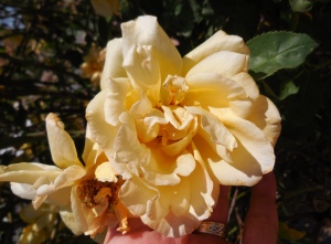
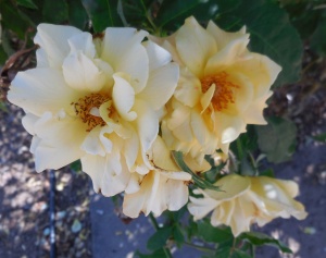
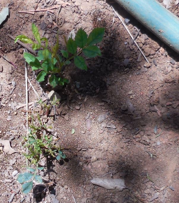
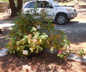
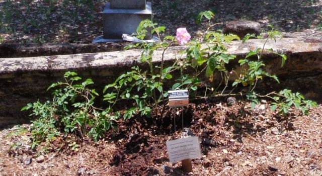
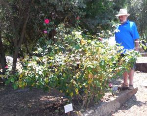
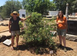
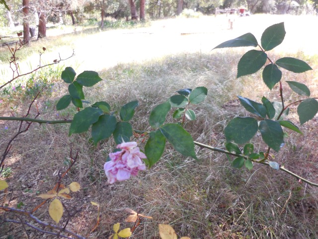
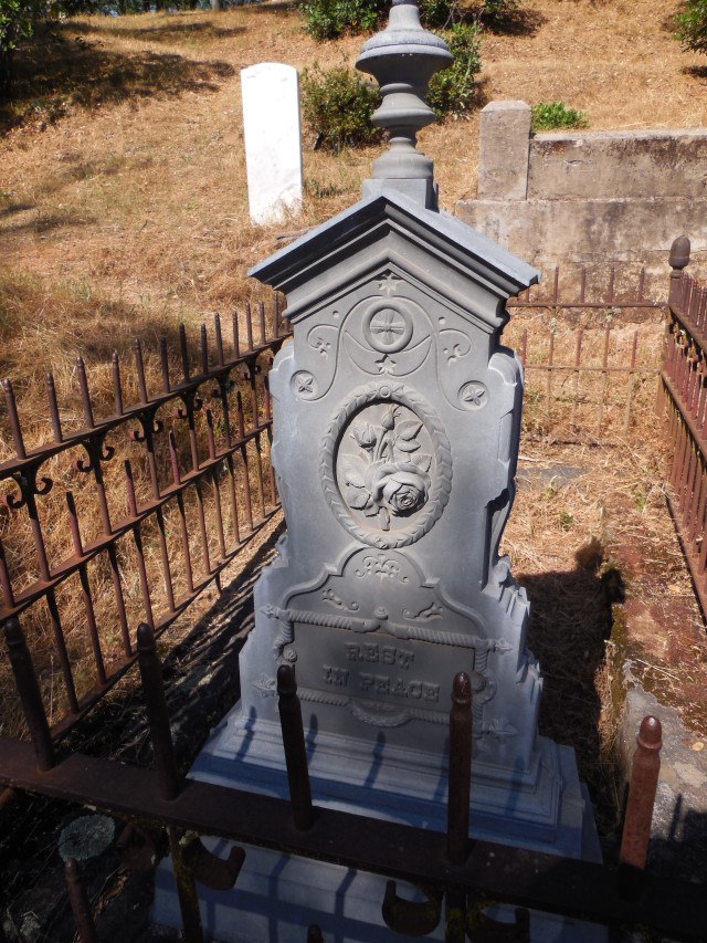
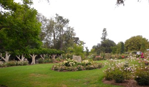
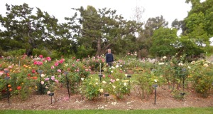
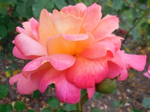
A surprise- the owner also grew a few roses. This looked like it might be an old tea rose.
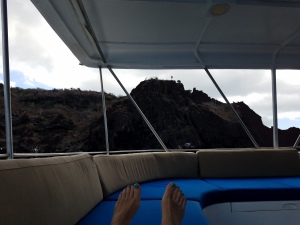
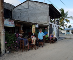
After seeing dozens of tortoises, eating lunch and perusing the gift shop, we got back on the bus for a visit to Puerto Ayora, Juan’s home town and one of the few towns in the Galapagos. It’s full of tourist gift shops, and I got a t-shirt for me, one for Adrienne and a bib for the grandchild I’ll be getting in July. The ice cream shop had free internet, so I posted some photos to Facebook and deleted junk email. If we wanted to rent a wetsuit, we had to do it before we left. I didn’t get one, but the water was cooler than normal for this time of year, which didn’t matter near the central islands, but it was too cold to snorkel without one around Isabela, so I should have rented one. The bus took us back across the island to the ferry landing, where we got on the panga boats and they took us to our yacht. It was dark by the time we were waiting for the pangas and I got a good look at the stars. I was able to find Canopus right away. It was a bit exciting and a bit scary to have our first panga ride in the dark. It seemed like we went several miles, and took quite a long time to get to the yacht with only a couple buoys for guidance. Finally, we pulled up to the back of the Tip Top III and got on board. Felix explained the yacht rules and customs, such as the 5-minute bell before meals, and told us to go down the stairs backwards. Our luggage was already in our assigned rooms. We had dinner, unpacked, plugged in chargers and went to bed. The yacht traveled at night to the next day’s starting point.
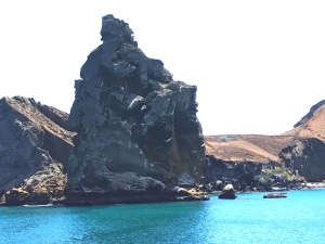
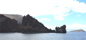
February 3. The island I could see through the porthole when I woke up looked somewhat like a large fat man floating with his penis sticking up. Juan told us later that day that the “penis rock” had been used as target practice during WWII, and used to be larger and a somewhat different shape. I’d like to see old photos or drawings of it. It is actually called Pinnacle Rock, and there are lots of good pictures of it online. They say it’s an eroded tuff cone.
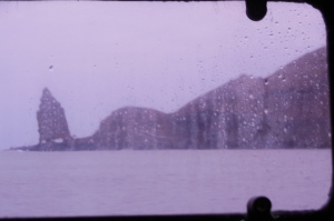
View through the porthole
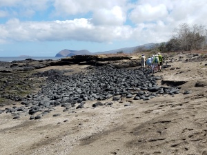
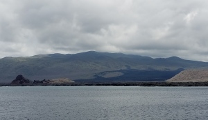
The yacht was anchored in Sullivan Bay, between Bartolomé and Santiago Islands. After breakfast, we rode in the pangas to a 150-year-old lava flow on Santiago. I was once on a 50-year-old lava flow and this didn’t look much different.
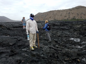
On the lava flow
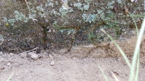
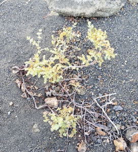
Only 2 plants grow on this lava flow, and they are few and far between. The first plant to colonize lava is Mollugo crockeri. It barely looks like a plant, lying flat on some surfaces.

Mollugo crockeri
More recognizable is the lava cactus, but they are quite rare.
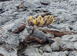
Lava cactus
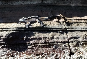
Jumping around on the lava are painted locusts (which eat Mollugo ), and looking for those are the lava lizards.

Lava locust
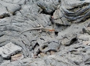
Lava lizard
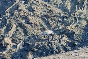
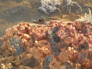
The features of the lava itself are fascinating to me. Being pahoehoe, the flow features are still fresh, looking like it has just happened. Some flat surfaces sheltered from weather and sun were green and glassy. And there was a round ball-like rock with a hole where lava had spattered out all over the outside of it. That’s something I haven’t seen before.
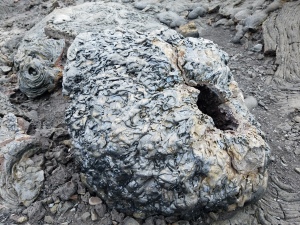
Spattered lava ball
At the beach, the lava was covered with Sally Lightfoot crabs. (We later saw them everywhere that rocks and ocean met.)
Later we went back to the beach with snorkeling gear, got everything adjusted while in the shallow water, then swam along near the rocks for about 20 minutes looking at the fish. I saw Blue Chin Parrotfish, King Angelfish, Sergeant Majors, some Triggerfish and Black-Striped Salema. I tried to use my phone camera underwater in its waterproof plastic bag, but I couldn’t turn it on. It turns on just fine when the bag is dry, but I discovered that if the outside of the plastic is wet, the phone doesn’t register my finger swipe. I did like my full facemask-snorkel combo. It took a bit of adjusting to get all my hair out of the top edge, but after that, I liked it much better than separate parts.
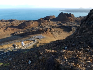
After lunch and a siesta, we took the pangas to the landing at Bartolome, where a boardwalk trail leads to the small light at the top of the highest peak.
Pinnacle Peak from the panga
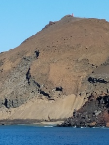
The peak we needed to climb to get to the light at the top.
The dry landing was a bit dicey because it was high tide, and some waves covered the landing. I think we all managed to get off the pangas between waves. The island is covered with vents from all the volcanic activity that occurred there. There are also more plants, as the rocks there have started breaking down and there is a bit of volcanic sand and gravel on most surfaces. The first area we passed had Tiquilia plants. They are the next stage of pioneer plants on lava.
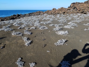
Hillside covered with tequilia plants

closeup of a tequilia
There was also a type of sedge and lentejilla.
sedge with interesting volcanic channels above it.

Lentijilla plant on rocks
The boardwalk had a few rest areas, for which I was grateful- it gets fairly steep. Between the main part of the island and the penis rock part was a sandy isthmus covered in saltbush and spiny bush. The views from the top were spectacular! All those vents, in many sizes. And so little erosion due to the fairly dry climate.
Near the top, looking down on the many cones
An unidentified plant near the top.
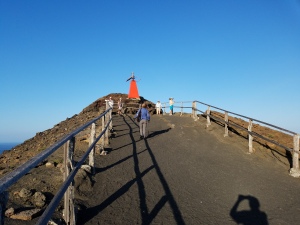
Looking up at the light
A rock showing both glassy surfaces and pumice-like surfaces.
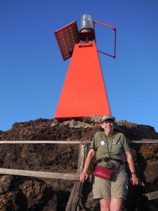
Me at the light.
Juan told us that near the landing there is a large, round, underwater crater that is very deep. We couldn’t see it due to the high tide, but I have since seen photos online (google: Bartolome crater).
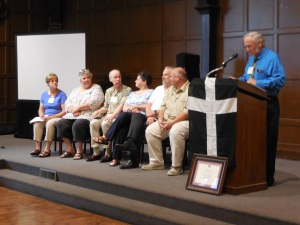
In the evening on the Tip Top III, we finally got around to introductions. Carolyn is from Ontario, Canada, Kay from Colorado, Kitty and Marge live in Texas, Phil and Veronica live in San Diego and Chile, David and Betty in Mendocino, George and Suzanne in Arizona, Jerry and Nancy in New Mexico, and Geri in Florida. Jerry and George have known each other since they were in the Peace Corps in Equador in the late 60s, and both their wives are also RPCVs (Returned Peace Corps Volunteers). That makes one-third of our group RPCVs.
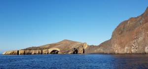
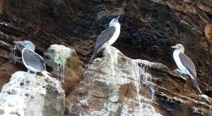
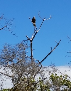
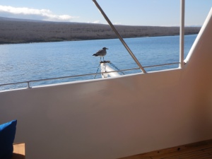
February 4. Today we woke up in Darwin’s Bay, Isla Genovesa. The bay is a collapsed caldera, and except where it is open to the sea, there are cliffs all around.This island is north of the equator (I crossed it 8 times on this trip.) Our first stop was a landing at the base of El Barranco, aka the Prince Philip Steps, on the east side of the bay. Apparently, the Prince had visited the Galapagos in the 1950s. The lower steps are a challenge, and it’s all steep, but there are (somewhat rickety) railings, and we helped each other as needed. At the top were birds: Red-Footed Boobies nesting in the low Palo Santo trees, Nazca Boobies nesting on the ground and Frigate birds scattered around. The Frigate Birds also nest here, but their nests are not next to the trails.
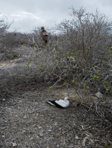
Nazca Booby on ground, Red-Footed Booby in Palo Santo tree.

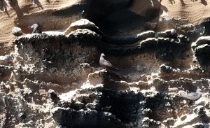
The row of rocks marks where people can walk. The boobies can and do walk everywhere.
The simple nest is outlined by birdpoo.
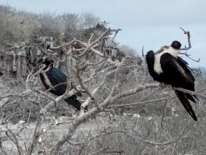
Female Frigate birds. They have some white on their chests.
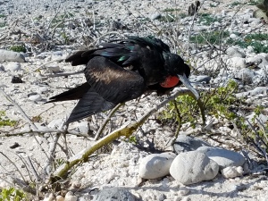
Male Frigate birds have a red inflatable pouch on their chests.
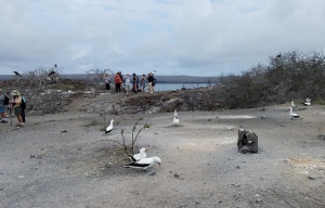
Nazca Boobies ignoring yet another group of tourists.
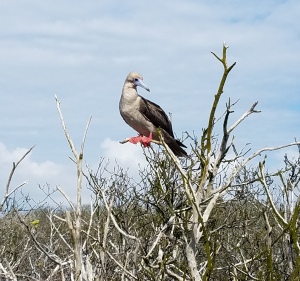
My best Red-Footed Booby photo.
The boobies make sparse nests and lay 2 eggs. If the first one hatches and does well, the baby will push the other egg out of the nest. The second egg is really just an insurance policy in case the first one doesn’t survive the first couple days after hatching. Boobies never raise both chicks. Juan referred to it as Cain and Abel. There were lots of these birds, and their nests were close to the path. They completely ignored all of us and all the other groups who visit. They have never been harmed, at least since the National Park has regulated access. People can’t just decide to go there. You need to be with an accredited guide. And the Park doesn’t allow too many tourist groups on any day. We followed the trail through the nesting area, where there was also a Galapagos Dove, a Mockingbird, and a short-eared owl in a crevasse.

Galapagos Dove
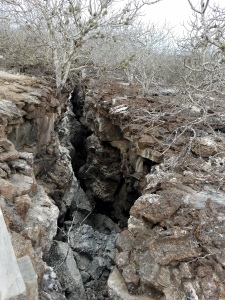
A large crevasse. An owl was seen in the crevasse but is not in this photo.

Lichen in Palo Santo tree.
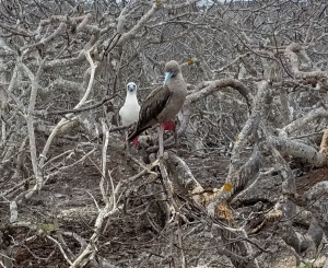
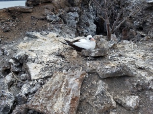
Parent and young Red-Footed Boobies.
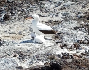
Parent and young Nazca Boobies. Parents do their best to shade chicks from the intense sun.

Muyuyo (Cordia lutea) plant. We saw this on several islands.
Eventually, we came to a lava field which extended to the cliff. We weren’t allowed on most of the field so we watched the birds in the distance. Hawks and owls prey on abundant shearwaters and storm petrels. A Phalarope and a tropicbird were also seen. One owl was sitting in the path, about where the path ends.

Owl perched above a Nazca Booby.
Both the owl and petrels are active during the day, an uncommon habit for both types of birds. It then flew up into a palo santo. We all tried to get as close as we dared to get photos without disturbing it.

Unidentified plant near lava field.

Booby shading chick
Getting back down the steps was dicier than going up, and I waited for the panga crewman to help me on the last one, as it was a big step and the lower one was wet stone. I was afraid of slipping on it if I didn’t have someone steadying me. Back in the panga we saw a school of golden rays swim by. On the cliff face there were lava gulls and a sleeping sea lion.
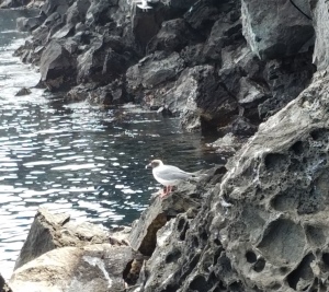
Lava Gull

Lava Gull and chick
A while later, we went snorkeling again. This time we had to get in from the panga boat, and the water was a little cooler than Sullivan Bay. It’s not my style to go all the way into cool water at once, but I did it. This time I saw Blue Chin Parrotfish, either Rainbow or Chameleon Wrasse, Yellowtail Surgeonfish, Moorish Idol and Giant Damselfish. There are a lot of books on Galapagos wildlife on the TipTop III, so I spent time after each adventure looking up what I had seen.
After lunch, we had a wet landing on the beach on the north side of the bay. There was also a trail around nesting boobies, and we could see swallow-tail gulls flying above the cliff. A skeleton, probably of an orca, had been laid out next to the trail.

Skeleton
Nearby was a large prickly-pear-type of cactus, but the prickles felt like hairbrush bristles- stiff, but not painful.

Soft-bristled Prickly Pear Cactus
I followed the trail around to where there were mangroves, then sat on the beach and cleaned the sand out of my wading shoes in the water of a small inlet. As I walked back along the beach, a mockingbird stood near me. It would walk ahead a bit and stop, ahead and stop, so I was able to get several good photos of it.
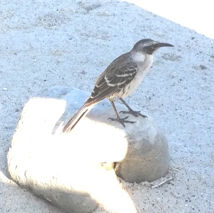
My friendly Mockingbird.
On the beach there were a few sea lions, some with babies.
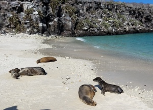
Sea Lions
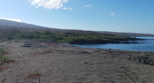
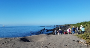
February 5. After traveling during the evening and into the night, we woke on the west side of Isla Santiago between Puerto Egas and Buccaneer Bay. We rode the pangas for a wet landing by a black sand beach at Puerto Egas. After drying off and changing shoes we explored the beach . There were a number of sea lions and baby sea lions hanging out on the beach, and they didn’t mind us being there at all. The rocks were thin layers of volcanic tuff.
Manzanillo tree at the base of the cliff.
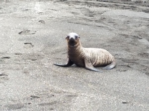
Sea lion pup.
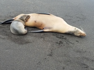
Sea Lion nursing pup.
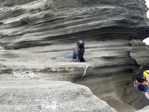
Tuff layers by trail up cliff, with sea lion pup.
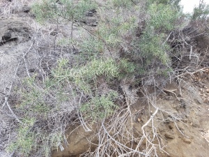
Spiny Bush next to the trail from the beach to the plateau.
On the plateau above the beach, there used to be a salt producing facility in the 1960s. A few remnants remain. Beside the trail at the top of the bluff, I saw Spiny Bush, Croton scouleri, Desert Thorn (Lycium) and Bitterbush (Castela). Thanks to Juan knowing at least the common name or Spanish name of every plant I asked him about, I was able to find the Latin names for most online or in books after I got home.

Croton

Bitterbush

Desert Thorn
We walked along the trail across a small peninsula for about a mile to a lava flow at the shore. On the walk, I saw acacia trees, prickly pear cactus and beach morning glory.

Acacia
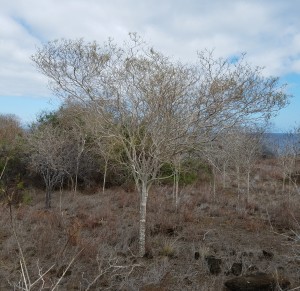
Palo Santo trees were the most common tree.

National Park marker by trail.
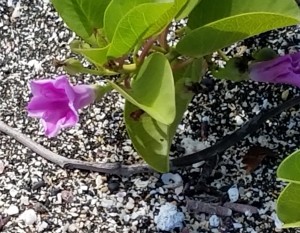
Beach Morning Glory
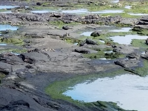
Ann saw that my calves were getting sunburned, and put sunscreen on them. We’d only been in the sun for about 15 minutes. What neither of us noticed was that, with my hair up in a ponytail to keep my cap from blowing off, my neck was also getting sunburned. Not too badly, fortunately, but legs and neck were mildly uncomfortable for the next couple of days, and I wore long pants so it wouldn’t happen again. The beach area was amazing! Our first stop was at “Darwin’s Toilet”. It’s a formation similar to a blowhole, made by a collapsed lava tunnel, but it doesn’t fill very far. Looking down from the top, you see water flow into the round area similarly to filling a toilet bowl, then flow out again with a sort of flushing sound. I could also see fish swimming in the water and the ever-present sally lightfoot crabs, and on a bit of a rock ledge below the top, a yellow-crowned heron hangs out.
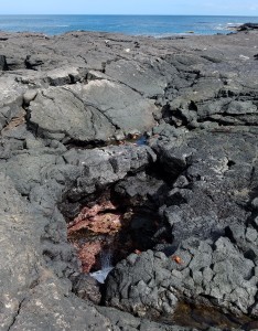
Darwin’s Toilet
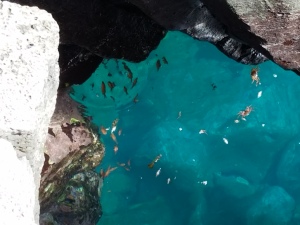
Fish and Sally Lightfoot crabs in the water.
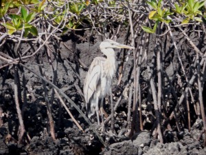
Yellow -Crowned Heron
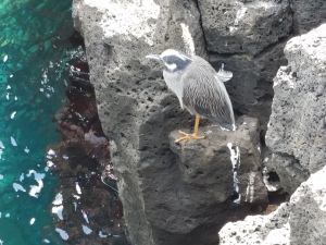
Same heron viewed from the side
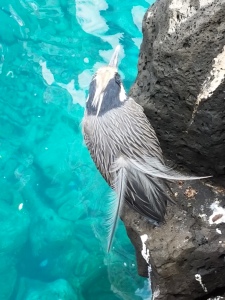
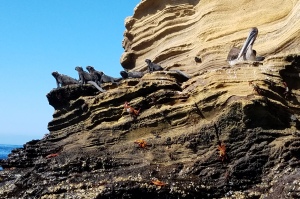
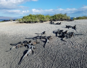
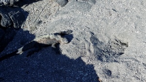
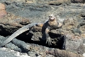
As we proceeded along, there were marine iguanas on the rocks. They have a special nasal-like structure on their faces where they eject salt, an adaptation for their aquatic lifestyle. Their skin, at least on the large males, is an orangey-red. They are usually in the process of molting some of their skin, giving those parts a gray color. Other iguanas are darker skinned, blending in with the lava rock. When in groups, they usually all face the same direction. We also saw lava lizards, some larger than others we’d seen. They’d climb on and over the iguanas. Fur seals could be seen in nooks staying in the shade. (The Galapagos fur seals are actually sea lions, but a different species from the other sea lions.) We walked along a sandy beach just inland of the lava rocks, and saw an oyster-catcher on a nest, standing over an egg to shade it, and some Darwin’s Finches. A pelican sat on the rocks by the ocean. There was also a curlew walking by the tidepools.
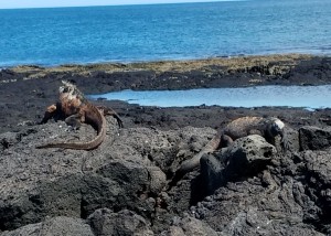
Marine Iguanas
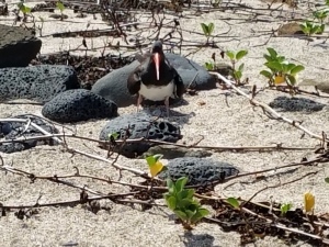
Oyster-Catcher shading its egg. The plant is Beach Morning Glory.
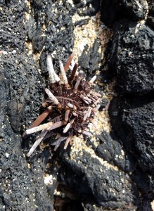
Sea Urchin
The Curlew is in the middle of the photo.
View of the beach, looking north across James Bay to a volcano that separates the bay from Buccaneer Cove.
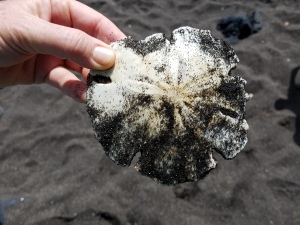
We found this sand dollar when we returned to the beach where we had landed.
On the yacht, looking back at the black sand beach on the right, where we had landed. A building on the plateau was a remnant of the salt mining operation.
We had a panga ride along James Bay, looking at the rocks and cliffs. We didn’t go ashore, but this is the area where Darwin spent a couple of weeks ashore and speculated that two different types of lava can come from the same magma chamber, speculating the density settling of crystals in the magma chamber would affect the chemistry of the lava erupting.
In James Bay looking north to the volcanic cone and Acorn Island to the west of it.
A lava flow just south of the volcanic cone, and view toward the shield volcano the forms the core of Isla Santiago.
After rounding the point, there was a cove with remarkable rock features on the north side promontory. This is Buccaneer Cove. One of the rock formations is called “The Monk”. It’s a pillar of lava rock that looks kind of human from some angles (google: The Monk, Galapagos).

The promontory on the north side of the cove. The Monk is toward the right side of the photo.
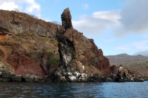
The Monk, so named because it reminded people of a praying figure.
Another rock looks a bit like a ship.
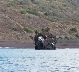
The ship-like rock
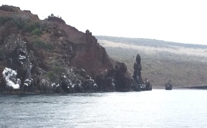
Another view of the promontory showing both The Monk and the Ship rock

More distant view of the promontory
I got one photo from the north side of the promontory, and a great many from the south side. It was a surprise when I looked at a page online showing a drawing by Darwin of the north side. I recognized it immediately.
North side of the promontory. Compare the left half of this photo to the Darwin sketch.
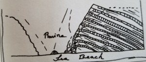
Darwin’s sketch
From here, we rode out and south to a small nearby islet, Isla Albany, to see marine iguanas and sea lions sunning themselves. The crew spotted a large group of birds, and we took the pangas toward them in the hope of seeing what they were after. We didn’t, but I got some cool videos of the birds.
East end of Isla Albany. Iguanas near the water, Sea lions higher up.
Birds very excited about something. In the background is the National Geographic tour ship.
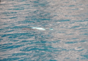
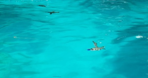
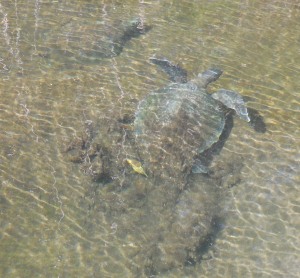
February 6. We woke up later than planned. We were supposed to have set an alarm so we could go up to the Captain’s Bridge and watch the instruments show when we crossed the equator, but one of us forgot to set the alarm. I woke up when I heard the 5 -minute bell for breakfast. During the night, the yacht had gone north and around the top end of Isla Isabela, the largest island, and shaped like a seahorse with a curled up tail. The body of the seahorse comprises three shield volcanoes, the tail has two. Where they join is low-lying, and the two parts probably haven’t been attached for very long, geologically speaking. We anchored a bit south of the seahorse’s nose- Punta Vicente Roca. There were green sea turtles swimming near our yacht. We could see a lot of them at a time, and I took several videos.

Sea turtle

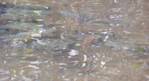
Sea turtle eating some weird stuff that looked like jellyfish tentackes.
I know this isn’t much of a picture, but that white streak is the underside of a “wing” of a Spotted Eagle Ray. I couldn’t tell what it was, but Felix recognized it right away.
On the panga ride at Punta Vicente Roca, there were several small caves formed by cracks or dikes on one side. Lava rock could be seen in some cracks, and in one case it had flowed onto the rocks of the hillside above. There were layers of volcanic tuff forming most of the cliffs.
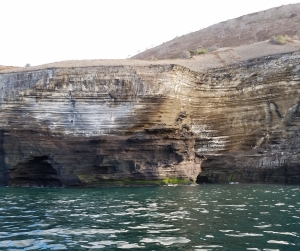
Layers of tuff forming the sea cliffs

small cave in the cliff
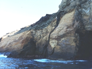
lava dike in the center and a cave on the right
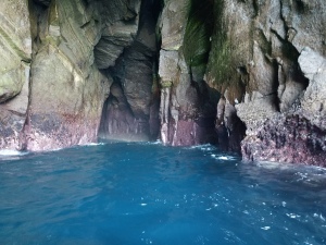
Inside a small sea cave.
View of Punta Vicente Roca
We went close to a cliff face where many birds were resting and grooming themselves on small ledges: Blue-footed Boobies, Lava Gulls, flightless Cormorants, Frigate Birds. Lower down there were crabs and a large, reddish, many-legged sea star. A wave covered it before I could get a picture, and I couldn’t find one in the books that looked like it.
Marine Iguana
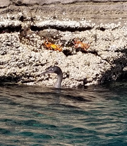
Swimming cormorant and Sally Lightfoot crabs

Marine Iguanas

Flightless Cormorant
Marine Iguanas and a pelican
Blue-footed Boobies

Blue-footed Booby
Lava Gulls
We then headed into a large cave where we saw penguins swimming and diving. There were also marine iguanas in the water. From inside the cave looking out we could see Isla Fernandina. Brown noddys dived for fish near the cave entrance.

Brown Noddys at cave entrance
Swimming Penguins

Swimming Iguana

Penguins near the cave entrance
There was another snorkeling adventure, but it didn’t last long. My mask was leaking a bit, and it was difficult to deal with my mask while treading water, so I signaled the panga to come pick me up. Ann got out soon after because the water was too murky for seeing fish well. Then the others also got out. This water was the coldest so far. Some people went kayaking, which I probably should have tried, but didn’t. I took pictures of the others in the kayaks.
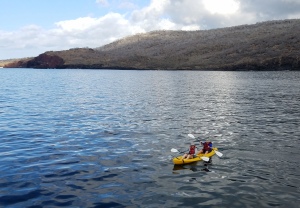
Ann and Geri kayaking
After our siesta we went over to Fernandina. It was a dry landing at Punta Espinosa beach, then walking past white mangroves and red mangroves to another lava flow. In the trees, I saw a hawk, an ani and more finches.
White Mangrove
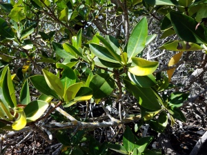
Red Mangrove
Mangrove in the water
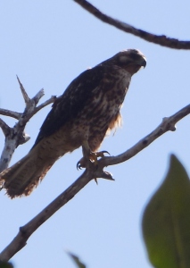
Hawk in a tree
Ani
In one of the lagoons we saw the rusting remains of what might have been a plane engine- a leftover from our occupation during WWII. There were a great number of marine iguanas on the lava. We saw the largest lava cactus of the trip. The trail markers had arrows painted on them, and I got a couple pictures where the iguanas were all lined up in the direction of the arrow. Juan pointed out the holes in the sand that were iguana nests.
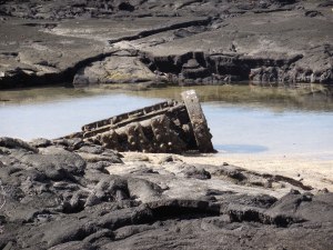
Leftover from WWII
Lots of Marine Iguanas here.

Large Lava Cactus
Iguana headed towards the nest.

Iguanas lined up facing the direction of the arrow on the trail marker.
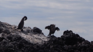
We saw a group of tourists from the National Geographic ship. They all had huge lenses on their very expensive cameras. Some also carried tripods. There were a number of flightless cormorants on rocks near the ocean. Sea lions were on the beach and in tide pools. Just before we left, one came up to us. It posed in several positions while I took pictures.
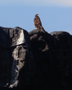
Hawk on the rocks

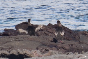
One of my best pictures of the flightless cormorants, showing the size of their wings.
View from Fernandina to Isabela

One of many photos I took of this posing young sea lion.
February 7. It was a short ride to Urbina Bay, so the yacht was at anchor most of the night. My body actually missed the gentle rocking in my bed. It was hard to sleep. Another of our group said the same thing. After breakfast we had a wet landing on a white sand beach. There were tracks from a sea turtle going up the beach. This area includes their nesting grounds, but the trail avoids getting near them. At the beginning of the trail were some trees with bare branches. Someone asked Juan about birds. He made something of a whistling or blowing noise, like, “whoosh, whoosh” and birds started landing on the branches right above us. A mockingbird, finches, a flycatcher and an ani.
Ani
Mockingbird
Darwin Finches and a flycatcher
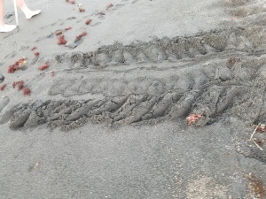
Sea turtle tracks on beach
More turtle tracs along the beach
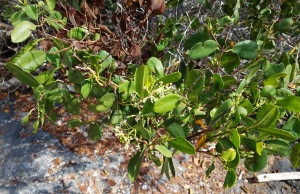
This area is well vegetated, and we walked by many plants I hadn’t seen before. Sea grass down low, Manzanillo trees, Macrea, Waltheria, Gossypium (Darwin’s Cotton)and Muyuyo trees.
Beach grass
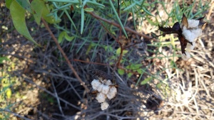
Glossypium- Galapagos sotton
Glossypium

Waltheria
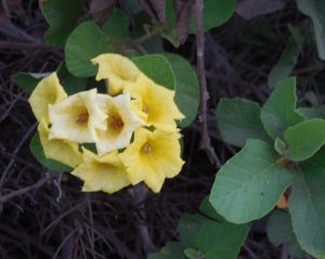
Muyuyo

Muyuyo with flowers and fruit
The Muyuyos and Waltheria have yellow flowers. Juan says most plants there have yellow flowers because the only bee native to Galapagos is attracted to only yellow flowers. The bee is large and black like our carpenter bees (xylocopa darwinii).
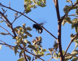
Galapagos Carpenter Bee
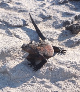
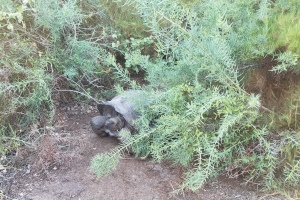
We could see places where land iguanas walked, and some holes to their nests, but we only got a good look at one of them. We saw another cross our path ahead of us, but he/she went down a hole at the edge of the path before we got there. At the end of the trail we saw a couple land tortoises before returning to the yacht.

Land Iguana. The only one I saw close up.

Hole where the iguana I saw from a distance went.
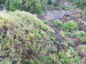
View of what most of the trail looked like.

Another view of the trail
Isabela Tortoise
Another Tortoise

Tortoise looking at us.

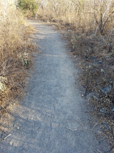
Sandy trail near the beach and view of the higher part of Isabela.
View west just before leaving the beach.
There was snorkeling here, too, but I didn’t go. The water was too cold. Someone told me it was the best snorkeling of the trip and they had sea turtles swimming with them. I stayed on the yacht and watched a lava gull on the railing.
Ann painted our toenails to match the Blue-Footed Boobies. This shaded open upper deck was my favorite part of the yacht for taking siestas after lunch.
Lava Gull
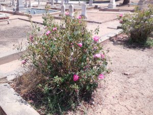
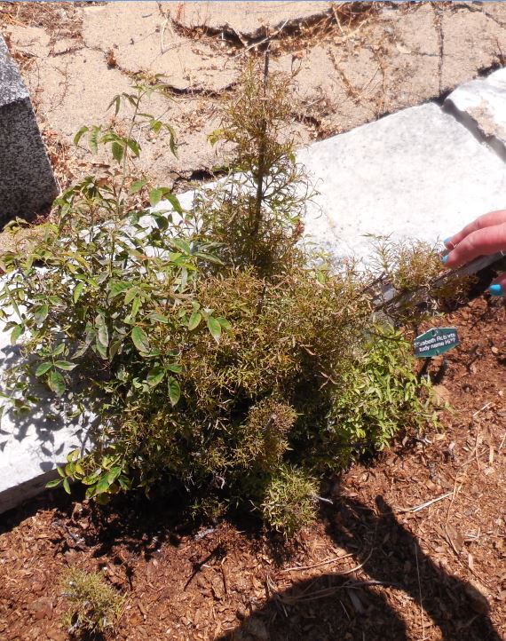
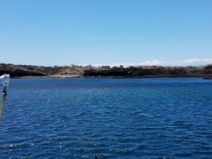
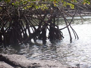
From there we headed further south to Elizabeth Bay, which is in the low lying area where the two parts of Isabela meet. We had a long panga ride amongst the mangroves. We would go to the end of a cove and sit quietly looking at the fish and sea turtles in the clear shallow water. We saw mullet, pufferfish and sardines.
Sea Turtles right next to the panga
Mullet. They have gray bodies and blue tails

A small Pufferfish

Sardines
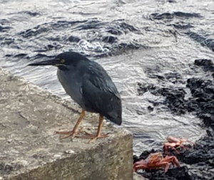
In the mangroves, we saw a striated heron.
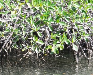
Mangroves with Striated Heron in the center.

Closeup of the heron.
As we were leaving the inlet we saw candelabra cactus and a great blue heron. Penguins swam in the water, and there were cormorants and sea lions on the rocks.

Penguins

Candelabra Cactus and view of volcanic craters on Isabela.
Great Blue Heron
Cormorants

Sea Lion
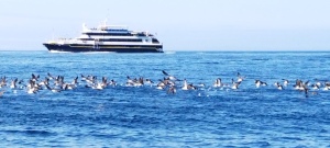
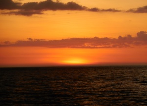
Back on the yacht, we started our trip around the tail of Isabela. Just before we left Elizabeth Bay, some fishermen came up (from where?) to the yacht in a small boat to sell fish to the crew. As the crew cleaned the fish on the back of the yacht, frigate birds started coming in droves to catch what the crew threw out to them. We sat on the upper deck taking photos and videos. It was amazing and lasted for many miles. Then we got to watch the sunset over the Pacific.
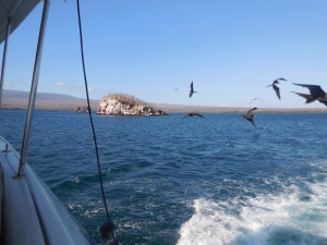
Frigate birds following us, hoping for handouts

After dinner, we were warned that the passage this night would be rougher than elsewhere in the islands. I didn’t take the dramamine soon enough. Felt lousy for hours and didn’t get to sleep till about 1 am.
February 8. Puerto Villamil. Our first civilalization after 5 days. It turns out that the marine iguanas and sea lions are just as happy living near the panga landing at Las Tintoreras inlet as they are in uninhabited islands. Iguanas would sit on the sidewalks and the sea lions lounged on benches. I saw a docked panga with 2 sea lions sleeping on its sides.
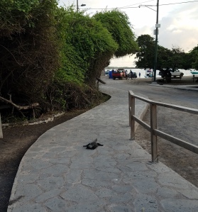
Marine Iguana on the sidewalk
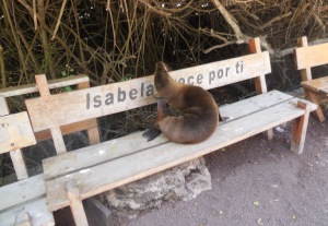
Sea lion enjoying the bench
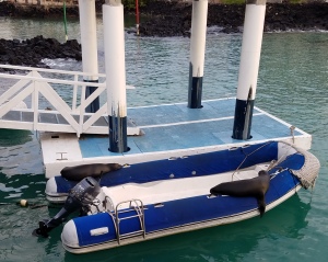
Visitors on a panga boat.
We had a bus ride (bus- a truck front with benches in back that you climb up to) around the town, which has many shops offering bike rentals and tours of lava tube caves. Plenty of cafes, restaurants and bars, too.
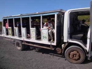
The bus on which we toured the town, and later rose to the start of the trail to Sierra Negra Crater.
There were fairly new expensive hotels charging 10 times the rate of the older simpler beach hotels.
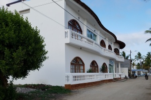
One of the more expensive beach hotels.
We went to the Arnoldo Tupiza Tortoise Breeding Center. There were all sizes and ages of tortoises from all over Isabela.The director showed us eggs- a bit bigger than a golf ball- and a newly hatched baby. When tortoises are sent back to the wild, they are returned to where they or the parents were collected.
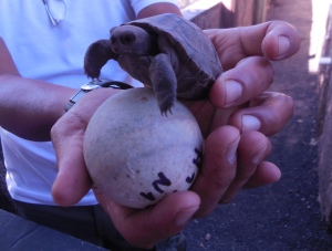
newborn tortoise and example egg
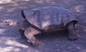
One of the Isabela tortoises. Note that the neck part of the shell is more arched than the others we’ve seen, allowing it to reach higher plants.
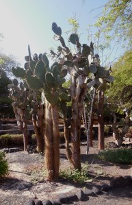
Opuntia galapageia, tree opuntia. We saw lots of these in both Villamil and Puerto Ayora.
The next stop was overlooking a small lake with flamingos- only four of them on the far side.

Distant flamingos.
We then dropped off a few of the group who didn’t feel like climbing to the caldera of Sierra Negra- the second largest caldera in the world. There were cafes in town, some with internet, but I don’t think they enjoyed the time there. The rest of us stayed on the bus, driving up the flank of the volcano through farm land (part of the 3% of the Galapagos that is not in the National Park.). The big trees were draped in lichen. We stopped by one farm because a Vermillion Flycatcher has been seen there by Juan and he hoped to find it, but no luck. (On the way back we drove by there slowly, but never saw the beautiful little bird.) Eventually, we came to the end of the road and the beginning of the trail to the caldera.
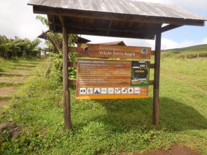
Start of the trail
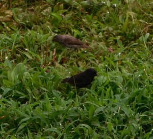
Darwin Finches in the grass at the beginning of the trail.
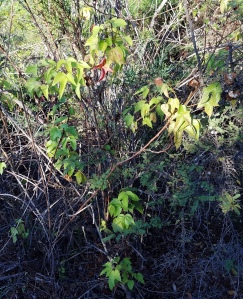
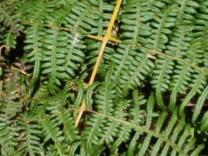
The trees in this area were mainly guavas that had been spreading by bird-dropped seeds from the farms. Acres of them were cut down as they try to eradicate them from the park. We saw some tree ferns (Cyathea weatherbyana).

Lichen
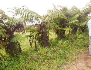
Tree Ferns
The trail wasn’t very steep till the last part, but it was steadily uphill and we stopped to rest a few times (which I REALLY needed). The view down to the ocean and small islets was amazing.
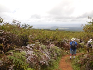
View from the trail
I asked Juan how many times he’s climbed it. He said, “Ooo, about a hundred.” At these higher elevations, ferns were the main understory plant.
Fern
Finally we reached the top, the edge of the caldera. The view was totally worth the hour of climbing to get there. The caldera is 6 km across. Part of it is black lava from a 14 square kilometer lava lake that resulted from a 2005 eruption.
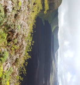
View of the caldera to the west . Black area is the lava that was a lava lake in the 2005 eruption.

View to the north in the caldera

East end of the caldera

Proof I was there.
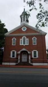
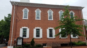
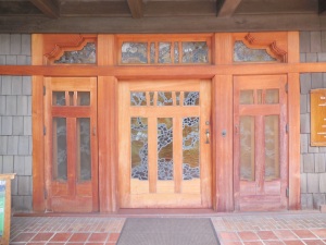
We got several group pictures before heading back down and picking up the others in town. After lunch on the yacht, we came back to explore the town some more. We went into a church that has stained glass windows of native animals, and a wooden tortoise under the altar.
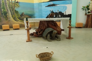
Altar of Church decorated with Galapagos animals
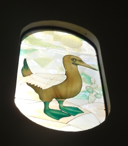
One of the stained glass windows
I got ice cream from a shop, and it was so nice in the heat. There was a soccer game between our crew and the crew of the TipTop II. Ours trounced theirs. A local bar served “Coco Loco” a coconut with rum added to the coconut water.
The bar that serves Coco Loco, and also has internet.
I didn’t try it, mainly because I don’t like coconut, and they apparently had a lot of rum. Ann, Carolyn and I went to the beach for a dip, which was very refreshing.
The beach where we went swimming
Lava Heron near the dock.
Back aboard the yacht, it was our last evening. On the deck, the whole crew joined us in a cocktail, and they put on some salsa music. Geri and Ann danced a bit with Juan and Felix. One of the crew was adept at napkin folding and towel folding. We found bird shaped napkins in wine glasses at dinner and animal shaped towels on our beds. After dinner, we repacked our bags. The checked luggage needed to be ready by breakfast time.
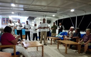
Cocktails and a toast by Felix. Juan is second from right in the crew. Our chef, Cesar, is wearing his toque
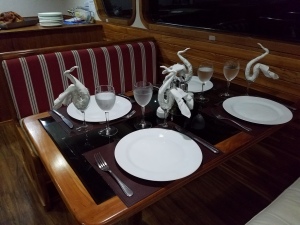
Folded dinner napkins
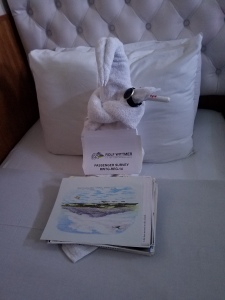
Folded towel on bed. Some of Ann’s artwork in front.
February 9. Travel to Quito. After breakfast while anchored at Puerto Ayora, we took our bags and rode the pangas to town. Our luggage was already on the waiting bus.
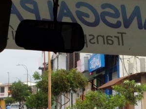
Last view of Puerto Ayora through the bus window
We drove back across the island to the ferry stop. Our luggage was put on the top and us inside for the 5-minute ride across to Baltra Island.
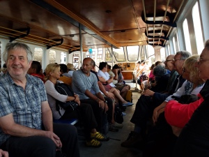
Passengers crowded into the ferry to Baltra

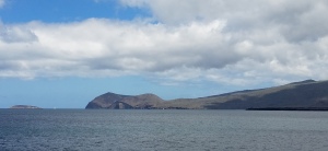
View from Baltra to Daphne Minor

View to Daphne Mayor. I’ve read that the snorkeling here is some of the best, but we didn’t go there.
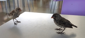
At the airport, we got our bags, looked through the gift shops, and waited in line to check in. Then we hugged Juan good-bye and went to the departure area. There were at least a dozen shops hoping we’d make some last minute purchases. In the cafeteria, I discovered that a few crumbs from my empanada would get several finches to hop around on the table, posing while I took my best photos of them.

On the flight to Quito, I loved the cloud formations. There is a cloud forest between the lowlands and the high Andes because the coastal clouds can’t rise as high as the mountains, and pile up against them. I could see Cotopaxi peeking up through the puffy cumulus clouds before we landed in Quito. Luis was there to meet us.
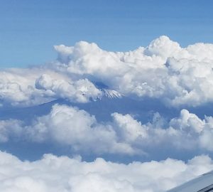
Cotopaxi in the clouds
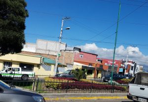
We stayed at a hotel in a town nearer the airport than Quito. It was nice to have a good shower and shampoo. There was a farewell dinner, as some people would be leaving that night. Hugs all around. Ann and I had pre-booked a trip to Otovalo, an indigenous town with a well-known marketplace two hours drive north of Quito for the next day. Three others were interested in joining us. It turned out Luis was to be the tour guide, and was able to make arrangements for the others to join us. That made it much more fun, so I’m glad it could be arranged on such short notice.
February 10. Otovalo trip. Luis had a van with a driver to pick the 5 of us up. We headed north. Cotopaxi was often in view. We followed a river gorge, and I kept trying to get photos of it from the window. The rocks were layers of tuff from the nearby volcanos. We saw that in one area, one type of tuff had been dug out leaving large holes in the hillsides. Luis had names for the rock types- cascajo (brown tuff), and congahua (white tuff) used in buildings and toothpaste.

View to the river gorge, showing tuff on hillsides.
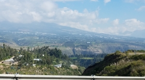
My best picture of the gorge.

Andes scenery

One of the high Andean peaks
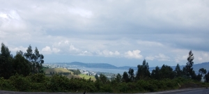
View near Otovalu
We drove on the Pan-American Highway through several small towns and stopped in Cayumbe. Luis took us to a side street, up an alley that led into a bizcocho factory. The name comes loosely from biscotti, but these aren’t cookies. The simple dough is cut into small pieces and baked to make a puffy buttery flaky pastry. We each got to try one and see how they were made in the brick oven inside the wall. There is a YouTube video that shows other tourists in that same factory. In the alley were several people selling local crafts. I got a dress and romper for the granddaughter I’ll be getting this summer.
Town of Cayumbe from the van window.
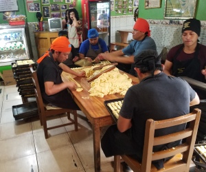
Making Bizcocho
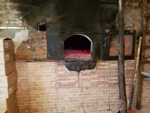
Bizcocho oven
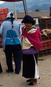
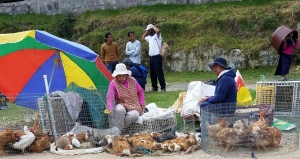
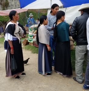
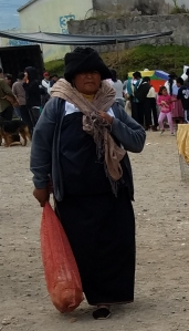
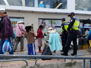
We crossed the equator- my 6th time this trip. The scenery on the drive was spectacular.When we got to Otovalo, Luis took us first to the animal market, as that would be closing up soon. Mostly they were selling chickens, but I saw cages with other fowl, Guinea pigs, rabbits, etc. One person had a couple kittens to try to rehome. But what I liked was seeing the indigenous people- their faces were so interesting, so much character in them. There were also people selling various types of clothing.

Next, we were turned loose in the market square in town for an hour and a half. Carolyn and I explored it together. Ann found a few things in the market, then sat down to make sketches. Carolyn got a woven belt and I got a woven strap for my ukulele. I also got a carved jade tortoise, an embroidered blouse for me and a sweater for my granddaughter. The woman selling the sweaters asked how big the child was, and I made a gesture of a pregnant belly. She laughed and looked for her smallest ones. I also found a nice doll for my foreign doll collection. When we got near where we were all to meet I saw Ann making sketches with a small audience- two police officers and a boy of about 8 or so watching what she was drawing.

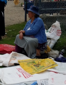
Woman selling straps and belts.
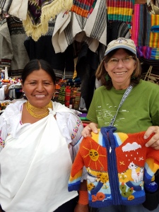
Sweater for future granddaughter.

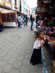
Views in the market square and side streets.

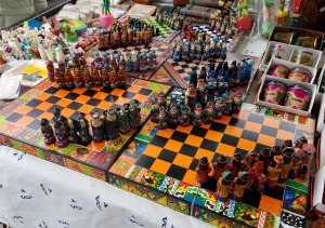
I liked this travel chess set- Natives vs. Conquistadors.
Ann attracting lots of attention as she made sketches.
There is a weaver’s guild and store in Otovalo, and that was our next stop. The place is named El Gran Condor. A woman welcomed us and showed us traditional techniques, starting with how alpaca or sheep wool is carded and spun, then things they use for dyes: achiote for red, chilca flowers for green, add walnuts for brown, and coccinila grubs for red. Luis translated for us. Next she demonstrated the traditional methods of weaving, and the larger looms. There were several rooms of handicrafts. We all wanted to buy many things, but the amount of space in our luggage limited us. I got a wall hanging of Galapagos animals and a pair of knitted socks with alpacas. They cost less than most of the socks I buy in Santa Cruz.
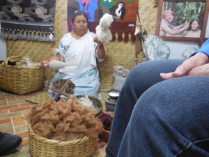
Hand-spinning demonstration

One style of traditional weaving. Luis explaining in English for us.

Demonstrating the floor loom.
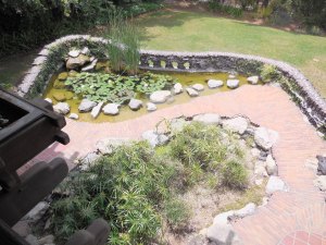
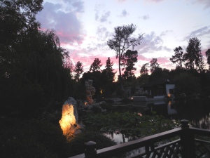
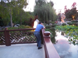
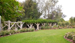
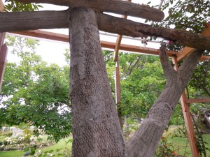
Lunch was at a Spanish style restaurant with lovely gardens that I wish we’d had time to walk around. The room where we ate had a dome in the ceiling Inside the dome an angel was suspended, and in its hand was a Guinea pig. I really didn’t know what to make of that.

Angel and Guinea Pig.
On the way back we stopped to take photos standing across the equator. My 7th crossing.
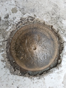
Geodetic marker on the equator.
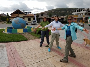
Me, Carolyn and Ann in two hemispheres.
After we got to the hotel, we repacked our bags and I changed into a clean T-shirt. Our flight home was delayed and not much fun, but we were very happy to finally arrive in San Jose Airport 8 hours late. (and one last crossing of the equator.)